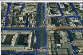
In an official blog post Google Earth product manager, Peter Birch, has announced the availability of Google Earth 6. This latest version of Google Earth introduces integrated Street View, 3D tress, and easier-to-use historical imagery.
With integrated Street View, it’s now possible to zoom from outer space into Street View in one seamless flight. From an aerial view the Pegman can be placed on any blue highlighted street or road for the seamless flight to occur.
In Google Earth 6 3D tree objects have also been introduced. 3D trees compliment the already existing 3D building models, with dozens of species available to add. Over 80 million tress are already ‘planted’ in Google Earth 6.
“While we’ve just gotten started planting trees in Google Earth, we already have more than 80 million trees in places such as Athens, Berlin, Chicago, New York City, San Francisco and Tokyo”.
Viewing historical imagery is now even easier. When historical imagery is available the date of the oldest imagery will appear at the bottom left-hand corner of the screen. Clicking this date will load that particular imagery set. A range slider will also appear in the top-right-hand corner of the screen where you can select imagery from the range of dates available.
Google Earth 6 is still in beta so it can only be downloaded directly from the website, and not through the normal update process.
Here’s a short video [0:48] introducing Google Earth 6: