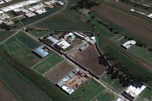
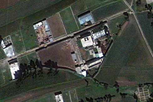
Google have today released an advance preview imagery update encompassing parts of Abbottābad, Pakistan where Al Qaeda founder Osama Bin Laden was killed during a co-ordinated and deadly assault by American Navy SEALs and CIA paramilitary forces. The update, which Google describes as “of particular interest”, is only available as an advanced preview KML file viewable in Google Earth, and will be included in Google’s next scheduled imagery update.


This higher resolution imagery was taken in May 2010 and is decidedly more relevant than the existing six year old imagery. In a blog post concerning the update Google have stated,
“Higher resolution imagery taken in May 2010 has been prepared for our next imagery update release. However, given the number of inquiries we have received about this area, and to help users better understand recent events, we’ve published an advanced preview KML of the new imagery for viewing in Google Earth. This imagery will be pushed live in Google Earth and Maps as part of our next periodic imagery update.”
Google have also said that they are working with their imagery provider to obtain even fresher imagery of the city in northern Pakistan. This imagery will be made available “in the near future” through the Historical Imagery feature found in Google Earth.