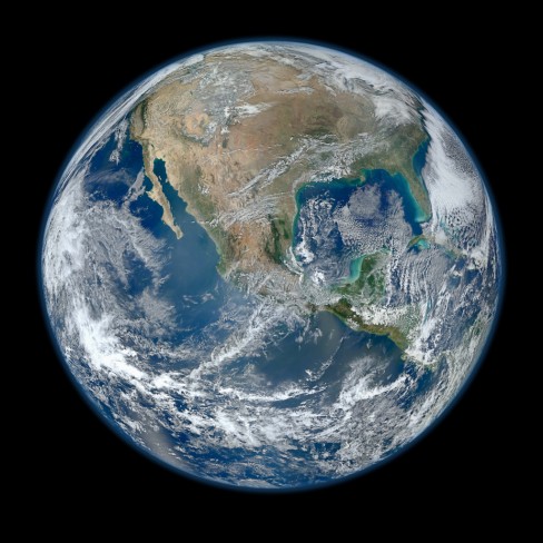
NASA has released another stunning Blue Marble image of the Earth, describing it as the “most amazing highest resolution” image yet.
The image was captured on January 4, 2012 using the Visible/Infrared Imager Radiometer Suite (VIIRS) on board NASA’s recently launched Earth-observing satellite – Suomi NPP. Suomi NPP continually observes changes occurring on the Earth’s surface.
The image is a composite one, created from a number of individual shots taken during several passes of the Earth’s surface.
NASA has previously released two iconic Blue Marble images of the Earth, one taken in 2010 and another in 2002 – instantly recognisable as the default background image on early iPhone models.
Our earth is stunning, absolutely beautiful.
Let us pause for a moment and look at these detailed images to appreciate the vast and dynamic treasure we have inherited.
Surely we can find a way to solve our problems as the one people that we are.
Surely we can get along enough to save our home, and the home of children and grandchildren.
Very cool!
Very cool!